I have been trying to figure out certain aspects of the zumo XTs behavior since I mounted one on my motorcycle. I’ve been quietly following the zumo discussions here for a while. I’ve learned a lot from the smart and knowledgeable crew here. Thank you all for that. I think I finally have something to contribute.
I have generally had good success starting routes at the “Closest Entry Point” but the occasional unexpected behavior caused me to wonder what exactly is a “Entry Point”, and what exactly makes one of them the “Closest”. I’ve done some testing or experimenting as well as some emailing with Garmin support. The purpose of this post is to share what I think I have figured out. A short simple two point route example illustrates.
As many here already know, when starting a route, the zumo XT asks the user to select the “Next Destination” and offers the route’s via points as choices. This originally led me to believe that the Closest Entry Point was the closest via point. I was wrong. I next thought it must be the closest via or shaping point. Still I was wrong.
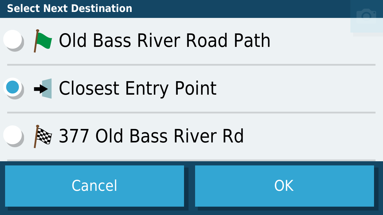
- CEPselect.png (88.25 KiB) Viewed 1442 times
As
@jfheath has explained
https://www.zumouserforums.co.uk/app.php/ZXT-P26 a route, once calculated, is made up of three types of points: via points, shaping points, and additional “hidden” or “ghost” points. The additional points are added by the software during route calcluation. (They are seen as route point extensions in a gpx file and as small dots on the map if a route is converted to a track.)
It turns out that an Entry Point can be any of those three types of points. Garmin support eventualy confirmed that for me by email.
So how is the “Closest” entry point selected? I’ll note up front that (1) “Closest” does not always mean the “most desirable” and (2) what follows is my own theory, backed up by my own testing and experience, but not confirmed by Garmin.
Recall the case of following a track where, when off track, a straight dotted line appears from current position directly to the track (magenta line). Since the device must draw a line between two points, that dotted line must be from current position to the closest track point. No roads or route calculations are involved.
When a route is converted to a track, the track points are the same set of points as the complete set of via, shaping and hidden points. It would make sense that the same logic used for the dotted line is used to determine the Closest Entry Point. In other words, my theory is that the Closest Entry Point is the via, shaping or hidden point which is the shortest straight line distance from the current position, regardless of roads or routing. (Compared to calculating straight line distances, it would take a lot more time and computing power to calculate all of the routes from current position to each via, shaping and hidden point.)
For a simple demonstration of this theory, consider a planned route along a road and a rider on a parallel road trying to join that route. It would be logical for the rider to continue down the current road in the direction toward the route’s finish and join the route at the next cross road (Old Chatham Road for the case shown here).
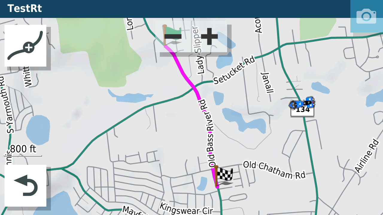
- CEProute.png (588.46 KiB) Viewed 1442 times
The Closet Entry Point is obviously somewhere on Old Bass River Road (the entire route is), but depending on how far down Rt. 134 the rider is, the closest straight line point may be nearer to Setucket Road than to Old Chatham Road, in which case, the resulting route calculation will go that [less logical] way.
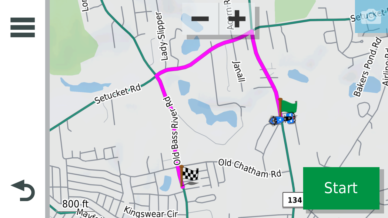
- CEProuteFromA.png (531.06 KiB) Viewed 1442 times
If the rider is just a bit further down Rt 134, then the closet point will be nearer Old Chatham Road, and the resulting route will be more logical.
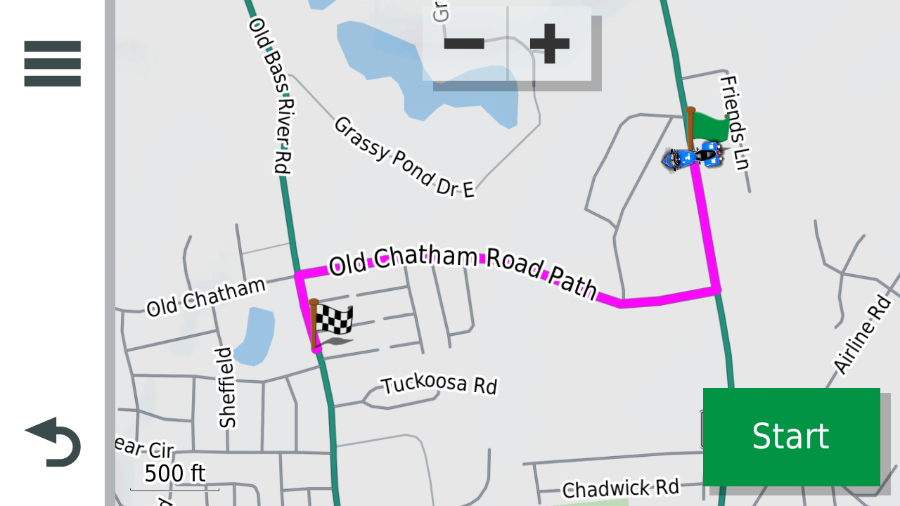
- CEProuteFromB.png (404.54 KiB) Viewed 1442 times
I used the simulator to capture the above screenshots safely, but it is compatible with my actual road experience.
Further support of the theory can be demonstrated by converting the route to a trip so that the entry point candidates (the track points) are visible on a map. I did this in Basecamp. The track points are a bit hard to see, so I marked the ones of interest with orange squares. If the rider happens to be located at red circle A, then the closest point in the route, by straight line, is at orange square 1. A route calculated from A to 1 would follow Setucket Road. If the rider happened to be at point B, the closest route point would be at 2 and the route calculated from B to 2 would follow Old Chatham Road.
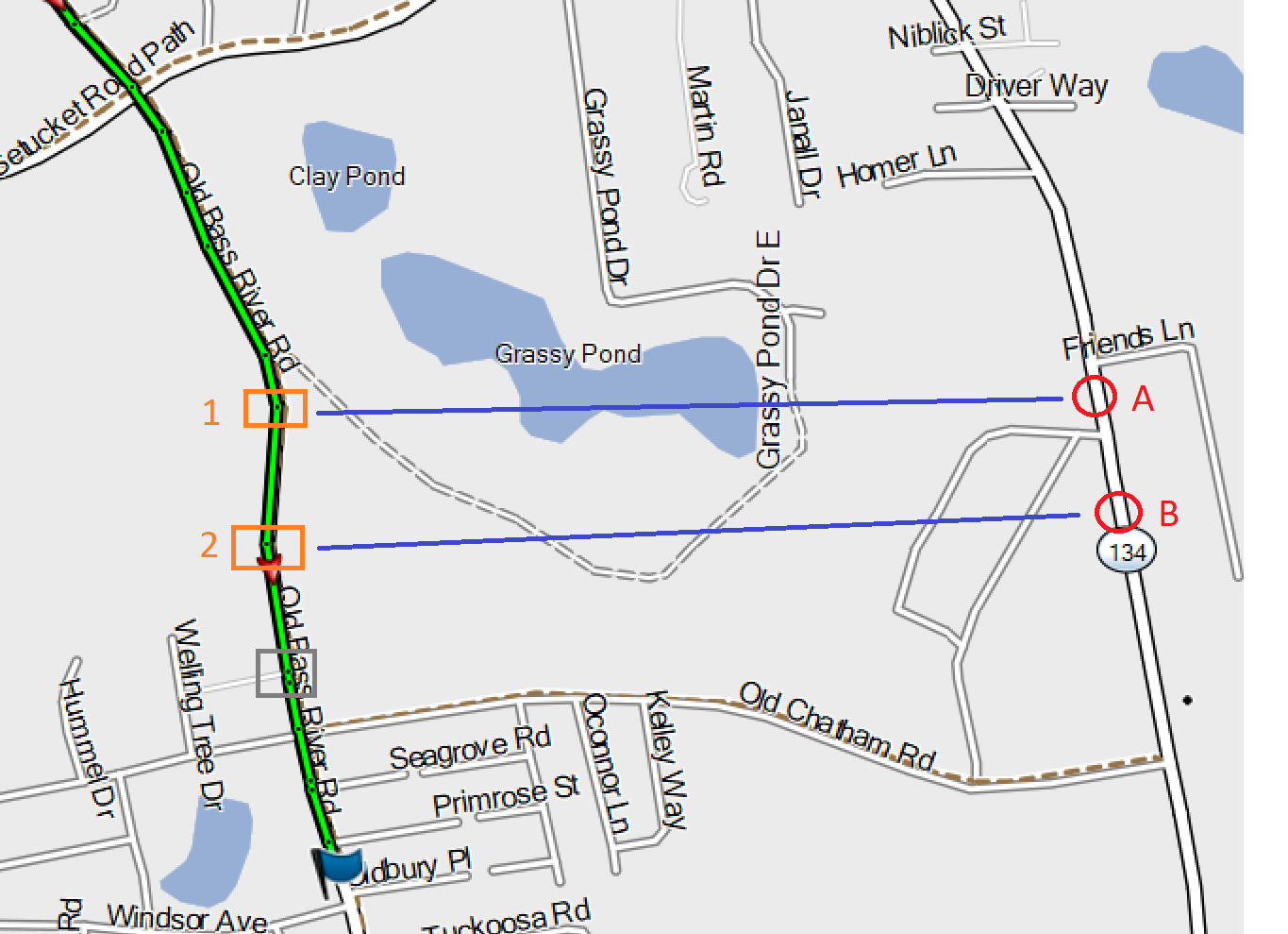
- CEP.png (235.73 KiB) Viewed 1442 times
Fortunately, the system recognizes that the route from B to 2 joins the original route at the corner of Old Chatham and Old Bass River Roads, so the planned route is picked up from that point without heading to 2 and doubling back.
For this simple example, the route difference is trivial. If the two parallel roads were on opposite sides of a river, with bridges 20 miles apart, the CEP and route calculation might be more important.
Note that, at the start, the zumo did not “know” which way the motorcycle was facing. If closest entry point had been selected while, or after, the motorcycle was moving, there might be additional affect, especially if U-turns are not allowed.
I'll allow some time for those more knowledgeable than me to shoot holes in this theory before I take it any further, but I think CEP logic might be applied when a rider goes off route. If true, the above might have implications for RUT.