If you have a Google account you can create a shareable map using Google My Maps. We do this to share our planned route with friends and relatives in advance of our trips. It can be viewed, zoomed, and panned on any device or PC. You can also select the base map.

I've done this two ways. First, if I have a track (created from a route in BaseCamp, for example) I can directly import this into My Maps and share a link. The file resides in your Google Drive. If I have a route I must first run it through
GPS Visualizer to create a KML/KMZ file that can then be imported into My Maps. The benefit of the second method is that it includes all of your shaping and via points which you can toggle on/off and shuffle into new map layers to customize the view. See below:
Method 1
Method 2
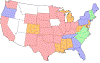
I import entire multi-day trips that are differentiated by the color of each day's route.