This is an issue that I came across today while testing out a tried and tested route for observing the behaviour of the Repeated U Turns.
To understand this, you need a picture. And you will need to click on it to get the full size image.
- Route Map.jpg (113.32 KiB) Viewed 1458 times
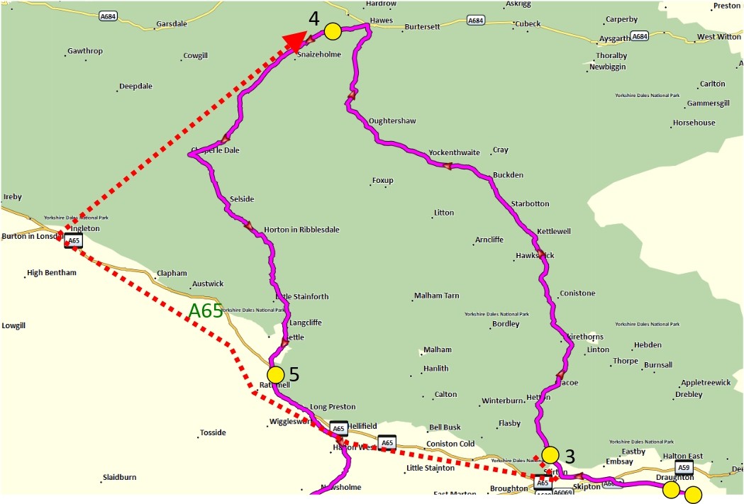
The picture shows the BAsecamp route that I loaded into the Zumo. The yellow circles are all Via Points.
Nos 1 & 2 , bottom right corner are the start point and a 2nd point close after that I intend to Skip after passing through the start point.
Point 3 is a token gesture that I am taking the route north along the B6160.
Point 4 is a Via Point on the road I intend to take, leading away from Hawes - The B6255.
Note Ingleton - is a town at the SW end of the B6255.
Point 5 is at a hamlet called Cleatop Just after the point where My Route and the A65 join up.
The dotted red line is the route that the XT calculated after I pressed to SKIP point 2. THe entire route was recalculated, The new route visited point 3 on the B6160 and then tunred round to go along the A65 all the way to Ingelton, and then turn NE to pick up the Via Point #4. I have put the dotted red line below tha A65 - Point 5 is not part of that section of the route.
The XT's route will turn round just after Point 4 and follow the same route back.
When navigating the route - I got stuck in a RUT loop shortly after passing Point 3. However, that is not unreasonable. It probably IS quicker to turn round and travel the A65 to get to Point 4. That continues to be the case according to the XT routing (setting the bike position in simulation mode and seeing which route it takes to get to the Via Point.) From Conistone, the route north becomes the faster way.
However, it has already entered a RUT loop. I had U turns dis-allowed, so it had to use side roads to route me back, and these could be seen in the recalculated route - not taking the main road back, but deviating into all of the side roads where it had attempted to redirect me.
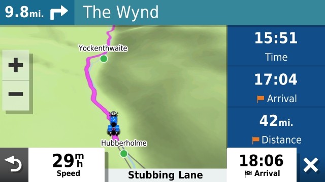
Beyond Kettlewell, the route was plotted ahead. And I do not understand this. The milage to the Via was about correct, but the XT had plotted a route NE from Buckden, and I was heading on my original route NW through Yockenthwaite. Immediately the XT tried to loop me back on the white roads E of Hubberholme, and abck to the A65 - or back to the point of deviation. I don't know which.
It then all became academic. The distance to Via Point 4 I reckoned was 10 miles. The Trip data on the screen showed 42. 32 miles more. Yet it had now decided to route me ahead again.
Now that was odd. It is about 15 miles from the via Point 4 to Ingleton.
- Hubberholme.jpg (39.17 KiB) Viewed 1458 times
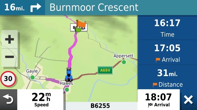
In Hawes the satnav was leading the way heading me towards the Via Point. Here is is on the screen, the Via Point about a mile ahead. (Don't ask me how the Explore green flags got on there. I didn't set it up to use Explore). But look at the distance to the Via Point. And it is the Hawes Via Point the XT is heading for - I checked by tapping skip and then saying No.
- Via Pt 4 Mile ahead.jpg (45.09 KiB) Viewed 1458 times
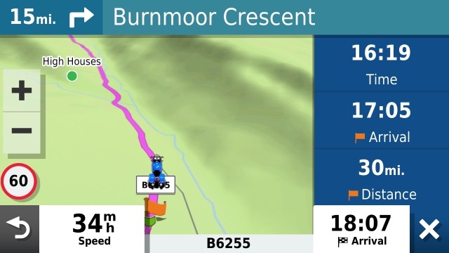
There were no announcements - approaching / arriving at - neither spoken or displayed. This is the screen just after I went through the Via Point.
- Through Via Point.jpg (41.5 KiB) Viewed 1458 times
Notice the distance to the Via Point and the distance to the turn. I hadn't got a clue where Burnmoor Crescent is, but I guessd Ingleton. Is the stanav heading for its route at Ingletone ?? That didn't make sense.
No the road is just wide enough for two cars to pass. Dry limestone walls lined both side and there is no place that the map showed where it could turn me round to head back. So 15 miles to Burnmoor Crescent. (Burnmore Rubber ?) and 15 miles back.
Hmm. Is Burnmoor Crescent in Ingleton ? Yes it is. It is the first place that the XT had the opportunity to turn me round using roads plotted on the map.
So I pondered on this for a while. Why ?
My route was planned not to go through Inlgeton at all. My route was planned to take an anti-clockwise route. The XT planned a different route - there and back. And it planned to approach route point 4 from the oppositie direction.
And I reckon that is why it was taking me 30 mile out of my way to visit a point that I had just passed through. I was on the magenta line - it should have recognised that. I passed throught he via point - it should have recognised that.
But it didn't - because I was heading int he wrong direction - and that makes sense.
But this is something to be aware of - it has nothing to do with the RUT. It is routing according to its recalculated route that came about from pressing skip. And it recalculated the entire route. And in itse route, it had to get to point 4 from the SW, not from the northeast.
And that means that it has to be taken into account when route planning. If you do like I did and have not route points between 3 and 4, then the satnav is free to choose its own route, and that may result in the XT expecting to hit the point from a different direction from what you expect. And that will certainly affect which roads it takes.
But I established before any of this, that the XT is still getting into a RUT - and it did it as soon as I left point 3 heading north.
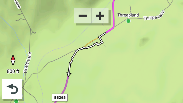
And this can be seen in the route back to the A65 from Cracoe. Going back is the quicker way from there, but it is still following the detours that I ignored on the road towards Cracoe.
There were 3 successive detours suggested in this area. All ignored. The main road back is the yellow line. THe kinks are taking me back through the detours that it suggested.
- Cracoe RUTs x3.png (155.92 KiB) Viewed 1458 times